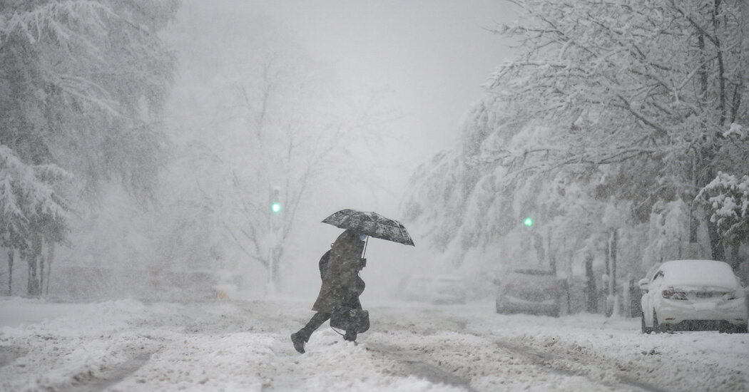
A strong winter storm was expected to bring snow and freezing rain across parts of the South and into the Northeast beginning Saturday, a mix that was expected to create hazardous travel conditions and potentially deepen supply-chain problems in the regions.
More than a quarter inch of ice was expected to fall in the Piedmont regions of North and South Carolina and more than a foot of snow was expected to fall from the Appalachians through upstate New York and southern and central Vermont. Snow was also predicted for parts of the Lower Mississippi and Tennessee Valleys, according to the National Weather Service Prediction Center.
“This is going to be a major setback for several days for companies trying to move products around the country just due to the scale of the storm,” Jonathan Porter, the chief meteorologist for AccuWeather, which is based in State College, Pa., said on Friday.
On Friday, Gov. Ralph S. Northam of Virginia declared a state of emergency and ordered the activation of that state’s Emergency Operations Center.
“This upcoming weather system is likely to include additional downed trees, more electrical outages, and significant impacts on travel conditions,” Mr. Northam said in the declaration. State transportation officials were caught off guard early this month, when a storm stranded hundreds of drivers.
He warned that the storm could produce wind gusts of up to 70 miles per hour along the coast.
In other parts of the South, meteorologists said that northeastern Georgia and the Carolinas were expected to bear the brunt of freezing precipitation on Saturday night into Sunday.
“While much is going to be said about the snow, we’re also raising the alarm of the ice storm that’s going to occur across the Carolinas,” Mr. Porter said. “It looks like that’s a recipe for extended power outages and tree damage in those areas.”
Temperatures fell to well below zero Saturday throughout New England and parts of New York.
In Saranac Lake, N.Y., the temperature had fallen to 12 below zero by Saturday morning and was expected to drop to 20 below zero by nightfall, with wind chills making it feel like minus 31.
All of northern New York and Vermont experienced temperatures below zero and were under a wind chill warning until Saturday afternoon, with the possibility of temperatures feeling as low as minus 45, the National Weather Service said.
“The dangerously cold wind chills could cause frostbite on exposed skin in as little as 10 minutes,” the Weather Service said.
Some airports and transportation departments were already bracing for potential travel issues.
Parts of the Carolinas, including Charlotte and Greensboro, were expected to see “the most damaging icing,” according to the National Weather Prediction Center.
“This will result in dangerous travel, power outages and tree damage,” the center said.
Southwest Airlines warned that travelers passing through airports across the South could see flights delayed, diverted or canceled. American Airlines and Delta made similar announcements related to the weather.
The Federal Aviation Administration advised travelers on Friday to check with their airlines for storm-related delays and cancellations.
Nashville could get three to six inches of snow starting around midday on Saturday, with higher snowfall amounts north of the city in what has already been a snowy winter, meteorologists said.
“Nashville may have more snow this winter than both Milwaukee and Chicago,” Mr. Porter said. “That’s pretty impressive.”
The storm system, which brought more than 12 inches in parts of Iowa and North Dakota on Saturday, was expected to continue moving southeast toward upper South Carolina, northeast Georgia and western North Carolina.
Dave Nadler, a meteorologist with the Weather Service office in Peachtree, Ga., said in a briefing that some ice accumulation in northern Georgia could be significant.
“We are looking at the potential for a significant winter storm,” Mr. Nadler said. “The looks of that and the confidence of that is starting to increase.”
The uncertainty in the forecast could be unnerving for those who live along Interstate 95 in Virginia, where the snowstorm this month left hundreds of drivers stranded in their vehicles for more than 24 hours.
The Virginia Department of Transportation was not taking any chances, and on Thursday its crews began spraying portions of I-95 with a solution of salt and brine, which helps prevent ice from bonding to roadways.


